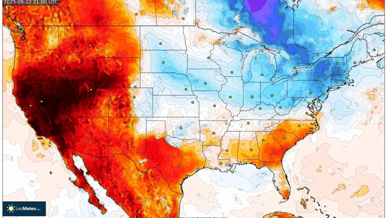
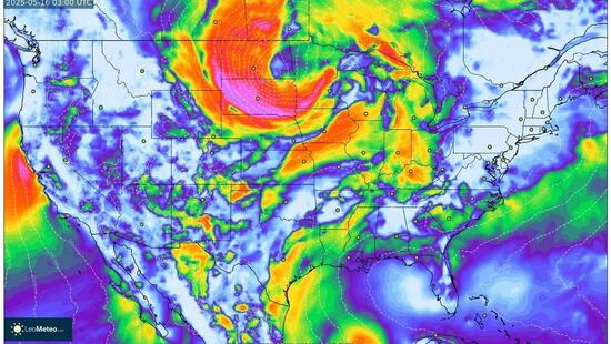
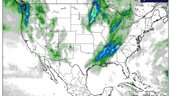
Weather radar and precipitation map
The rain radar, storm radar, and weather radar allow you to follow live on the precipitation map the movement of weather fronts over United States, with atmospheric discharges detected by sensors. It is the most accurate storm radar. The weather radar is equivalent to a live weather forecast. The precipitation map lets you check where it is raining, hailing, or snowing. Precipitation is shown with colors on the map: the stronger it is, the heavier the rain. Enabling map animation shows the movement direction of areas with rain, storms, and snow.
Live precipitation radar for United States, and the rest of the world
Rain radar data lets us track where it is raining, the intensity, and the movement direction of atmospheric fronts that bring rain, snow, or hail, together with storms. Precipitation intensity is shown in dBZ values. High values indicate heavy rainfall and, locally, hail risk.
Source: leometeo.com