Gale Alert! 15 May 2025 — Powerful Wind Gusts Set to Rip Across Texas and the Central U.S. (GFS 0.25° Forecast)
🌬️ Gale Alert! 15 May 2025 — Powerful Wind Gusts Set to Rip Across Texas and the Central U.S. (GFS 0.25° Forecast)
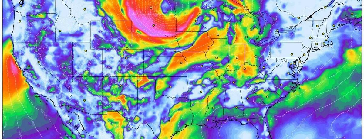
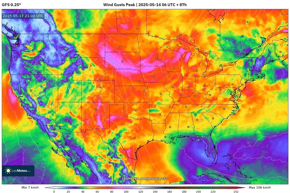
A vigorous mid‑latitude cyclone racing out of the Rockies is about to trigger damaging wind gusts across a swath of the United States on Thursday, 15 May 2025. According to the latest GFS 0.25° model run (14 May 00 UTC, +33 h), peak gusts may exceed 50–55 mph (80‑90 km/h) in parts of Texas, the Southern Plains and the Rockies, with blustery conditions spreading north‑eastward through the day.
🔍 Key Points at a Glance
-
Highest impact zone: South‑central Texas into western Louisiana, where a tongue of 55 mph gusts (deep orange–red on the map) races north‑east from early morning.
-
Secondary corridor: A “dry slot” punching across New Mexico, Colorado and western Kansas produces mountain‑lee gusts topping 45 mph, lifting dust and reducing visibility.
-
Cold‑front punch: By late afternoon the frontal boundary reaches the Mississippi Valley, shifting the wind threat into Arkansas, Missouri and the Mid‑South.
-
Great Lakes clipper: Tight pressure gradients around the low’s northern flank accelerate winds over the Upper Midwest and western Great Lakes late‑evening.
🕒 When the Wind Peaks (local time)
• Pre‑dawn (03 – 06): Gulf coast counties from Corpus Christi to Houston wake up to 35‑45 mph gusts as the low‑level jet mixes down.
• Morning commute (06 – 09): Core of strongest winds rakes central Texas; expect hazardous cross‑winds on I‑35 and I‑10.
• Mid‑day (11 – 14): Gusty arc races through eastern Oklahoma and Arkansas; scattered power outages possible in Austin, Dallas‑Fort Worth, Little Rock.
• Afternoon (15 – 18): Mississippi Valley braces for 40‑50 mph gusts; loose objects become projectiles, aviation delays likely in Memphis and St. Louis.
• Evening (18 – 22): Gradient shifts toward the Great Lakes; Chicago and Milwaukee may see 35‑40 mph gusts with whitecaps on Lake Michigan.
🏙️ Regional Breakdown & Hazards
Texas & Western Gulf Coast
• Gusts 50‑55 mph; risk of toppled trees, sporadic grid failures, choppy coastal waters and blowing spray on elevated bridges.
Southern Plains (OK, KS, AR, MO)
• Widespread 40‑50 mph; high‑profile vehicles vulnerable on north–south highways. Blowing dust in the Panhandle could briefly drop visibilities below one mile.
Rockies & Four Corners
• Downslope winds 45 mph in CO foothills; fire‑weather concerns rise where humidity dips below 20 %. Secure loose roofing and outdoor gear.
Great Lakes & Ohio Valley (late)
• Brief burst 35‑40 mph; choppy near‑shore waters and small‑craft advisories across Lakes Michigan and Erie.
👕 What to Wear & Carry
-
Wind‑resistant shell with elastic cuffs; skip umbrellas—they’ll invert.
-
Eye protection (sunglasses or clear lenses) in dusty zones west of I‑35.
-
Layered insulation for the Rockies and Upper Midwest, where post‑frontal temps tumble into the 40s °F by sunset.
-
Extra phone power‑bank in case local outages knock out charging options.
⚠️ Safety Tips
-
Park vehicles away from large trees and unsecured signage.
-
Delay high‑profile trucking routes if gusts exceed 45 mph—especially along I‑40 and I‑70.
-
For boaters: heed small‑craft advisories; waves build quickly after 15:00 on the western Gulf and again on Lake Michigan toward dusk.
-
Homeowners: stow patio furniture, grills, trampolines and construction materials before sunrise.
Data source: GFS 0.25° wind‑gust field, 14 May 00 UTC run, valid 09 UTC 15 May 2025. Interactive map and real‑time updates on LeoMeteo.com/model/gfs.
Stay alert—this is a fast‑moving, high‑impact wind event. Follow local National Weather Service offices for watches and warnings as the system evolves.